


Research
Dissertation
Maopewa iati bi “To abandon so beautiful a Dwelling”: Indians of the Kanawha-New River Valley, 1500-1760
This is an extension of the work I did in my MA thesis. While ethnohistorical, my analysis pulls from many different fields including geospatial theory, linguistics, paleoclimatology, and epidemiology. I examine the change of Indian inhabitants within the Kanawha-New River Valley from Siouan-speaking people during the sixteenth and seventeenth centuries to Algonquian and Iroquoian speaking people during the eighteenth century. Read more here.
History Blog
WV Native American history
This blog is dedicated to the discussion of Native history and issues in West Virginia. I am seeking oral histories, images and comments from West Virginia Indian residents. (I know you are out there.) Please help me get Indian History back into the WV and National consciousness. Read more here.
Posters

West Virginia Native American Geographic Information System
This was my first poster as well
as my first large GIS project. I collected census data concerning race
at the county level for West Virginia, Ohio, Pennsylvania, Maryland, Virginia,
and Kentucky from 1790-2000. My goal was to look at the number of Native
Americans in West Virginia in comparison to nearby states.
I came into three major problems. First, I was learning the technical
difficulties of historical GIS in the early 2000s while still new to the
technology myself. Second, the county level is an example of MAUP
(Modifiable Areal Unit Problem), but sadly the smaller census tracts
where not yet digitized. The counties outlines over time posed technical
challenges enough. Third, and most frustratingly, the identification of
individuals as Native American changed function and meaning through time.
The changes make it nearly impossible to compare figures of race statistics.
I have recently modified and updated this project but as of posting am
not finished the final products. These will be forthcoming after graduation
as a digital gazetteer. I am currently collecting the data available on
individuals identified as Indian in the census from 1870-1940.
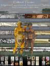
Cultural Theater: Indigenous Experiences at Jamestown and Sydney, 1607-1622 and 1788-1800
This writing seminar paper and poster was my first broad attempt to practice comparative indigenous history. While some major limitations are exhibited in my research and analysis, this is the beginning of a future project examining Jamestown 1600-1620, Sydney 1780-1800, and Waitangi 1800-1840.
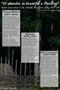
"To abandon so beautiful a Dwelling:" Indian Connections to the Middle Ohio River Valley, 1640-1754
This poster presents the original section outline for my dissertation. With the Monacan village reconstruction at Natural Bridge, Virginia in the background, the poster covers the Occupation, Removal and Reoccupation and its underlying logic. I found the process of creating this useful for short explanations of my dissertation. I have adjusted my structure to a seasonal section theme. Summer, Fall, Winter and Spring each represent different stages Siouan control, Siouan removal, landscape fallowing and Algonquian-Iroquoian settlement respectively.
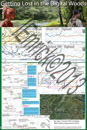
Getting Lost in the Digital Woods: GIS Exploration of the Native American Role in the Batts and Fallam Expedition, Sept. 1-Oct. 1, 1671
This is my latest poster selected from Chapter 3 of my dissertation and an article in development on the uses and dangers of GIS technology. I reconstructed the Batts and Fallam expedition using geospatial technologies like ArcGIS and Google Earth. More important than the specific locations mentioned in the text, I used this to examine the movements of Indian people connected with expedition. Intertribal collaboration and animosities were played out by the Appomatox, Saponi, and Tutelo guides. Mapping the trek helped put this all in context.