


GIS Portfolio
CRM and Teaching Tools
Historical Analysis of Census Figures, 1790-2000: A Preliminary Report on NAGIS (Native American Geographic Information System)
This was a preliminary report on issues of racial statistics in the USA Dicennial Censes. I collected Census data at the county level for West Virginia and the surrounding states for each decade.
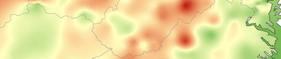
Second Creek Historic District Evaluation and Boundary Maps
This series of maps provided the Lead Investigator of the Second Creek Preservation Project with options for bundling properties for possible submission of the creek as a National Historic Register Nomination.
Demographic Evaluation of Zebu laws in India
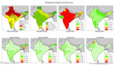
I developed his map to look at structural and geopolitical issues within Indian concerning Zebu laws. I used this in discussions about cross-cultural legal, social and religious differences in a Writing in the Social Sciences class. This also incorporates the use of maps in social science, issues of mis-representation in map-making, and layering cultural context. Most fun of all were the discussions of why a society does or does not eat a certain thing, ie Indian cows versus American dogs.
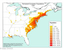
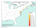
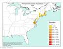
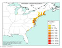
European Population Map Series 1625-1790. Adapted from Herman Friss's 1940 map series.
I digitized the line and dot maps of Herman Friss's 1940 article into point layers and then created point density maps that show the spread of Europeans across the US. These are used for powerpoints and made available to students and collegues for educational purposes.
 1700
1700 1770
1770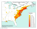
1650
 1720
1720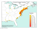 1780
1780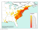
1675
 1740
1740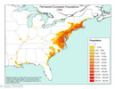 1790
1790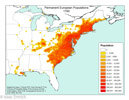
1760