


GIS Portfolio
GIS Writing Samples
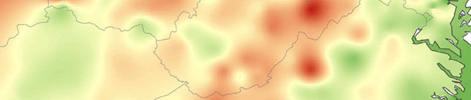
Coming Soon: Maopewa iati bi: Implications of Geographic Language in Appalachian Indian History
This paper applies James Merrell's 2012 critique of the language within Indian history to the growing study of poorly known Appalachian Indian groups like the Monytons. Merrell combined with James Carson’s work on ethnogeography forced a reevaluation of how I address Indian groups and landscapes within my work on Kanawha-New River during the sixteenth, seventeenth, and eighteenth centuries. With only limited references in the historical record, I have relied on archaeological sources to supplement the cultural understanding of these hidden people. Uncritical usage of words like Indian, village, territory, and even forest carry heavy European cultural and historiographical connotations, but how do we correct this? I discuss my particular solution using Tutelo terms such as wahtakai, mampi, Okahok amai, tahkai. Each has a rationale with discussion of the limitations of the semantic and cultural context. Complicating the selection of more appropriate indigenous-centric language, I conclude by examining the implications of recent work concerning Siouan-Algonquian-Iroquoian multiethnic Ohio Valley villages. The middle Ohio River valley remains a cultural and historical hole partially due to the linguistic ambiguity and complexity of the landscape and its people. Examining and carefully using indigenous landscape terminology, Tutelo in this case, fosters a more culturally sensitive historiography that provides a bridge across the cultural divide between the indigenous landscapes of the past and both academic and public audiences.
Functional Limitations of Current GIS
This a seminar paper on the long-term issues of GIS due to functional limitations with a particular focus on its application in history and archaeology.
Exploratory
Spatial Data Analysis Group Report
with Mike Harman, Josh Johnson, Frank LaFone.
This is the final project for an Graduate Advanced Topics GIS course. The project tested the use of Exploratory Data Analysis as used by Staticians in a GIS-spatial framework. We used 3D Analyst and the Immersion Geo-CAVE for exploring different ways to look at non-map uses of ESDA.
Contracted Maps
Maps for Women of the Mountain South
Selected Sites -|- Civil War Wheeling -|- Cherokee Land Claims
The editors of this collection of chapters on women in Appalachia approached me about an index map, and two content maps. The last to be completed, the Selected Sites map required a process of collaboration with the editors to limit the markers due to space and scale issues. Civil War Wheeling was the first map and required the most research using bird's eye view drawings and the earliest Sanborn Fire maps and Platt maps. The Cherokee Land claims map was one I had already developed abd adjusted for the editors specifications.
Cherokee Village Maps in Deconstructing the Cherokee Nation
The author sought me out to prepare this series of maps for comparing the changes in Cherokee village locations and names during the Eighteenth century.
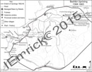
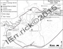
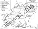
Bashkir Maps for Collegue's Dissertation (From Scanned Originals)
These maps were prepared from the scanned Russian language maps for a dissertation on Bashkir tensions with Russian control. Deciphering and decluttering the maps into a series required frequent meetings to tailor the maps to the collegue's needs.
Bashkir Uprising, 1584-1665; Bashkir Uprising,1665-1699; Bashkir Uprising, 1700-1729
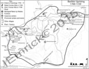
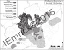
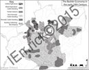
Bashkir Uprising, 1730-1785; Bashkir Economy mid 19th Cent; Bashkir Economy early 18th Cent